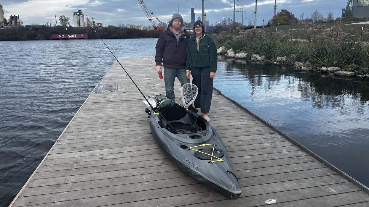
BRIDGEPORT, ILLINOIS – A young couple attached a kayak to the roof of an SUV before heading back home to Little Italy. Mere minutes before, Brian Delisi had finished his first kayaking venture on Bubbly Creek. He tested the waters solo this time, but his fiancée, Trina Mulligan, said they would return with two kayaks in the following few weeks. Save for a few fishermen, Park No. 571 in Bridgeport was empty on the chilly overcast Saturday afternoon.
McKinley Park Development Council (MPDC) hopes to see many more people on the South Branch of the Chicago River in the future. MPDC, an advisory nonprofit, published the South Branch Connectivity framework plan this summer. The plan was sponsored by the Our Great Rivers grant funded through The Chicago Community Trust. It would connect McKinley Park, Bridgeport, Chinatown, and Pilsen with a continuous trail along the river and nudge the residents of these four neighborhoods to engage with the river itself.
“Urban waterways have been engineered for industry not only in Chicago but around the world,” Sage Rossman said. She manages community programs at Urban Rivers, a nonprofit that focuses on the conditions of the Chicago waterways.
Technically, Bubbly Creek is a channel that was dug artificially in the 19th century. Plants and warehouse facilities relying on barge traffic blocked people from recreational river use.
“One of the biggest things locals can do is just to go outside and play on the river,” MPDC President Kate Eakin said. “The more people are using the waterfront, the easier it is to say we need more of it.”
A “good neighbor” collaboration is key to success
 A Bubbly Creek kayaker is testing the waters. Maggie Cooper from the Shedd Aquarium says herons and turtles aren’t bothered by an increase in recreational activities on the South Branch of the Chicago River. Victoria Malis // The Fulcrum
Since the framework plan was published earlier this year, MPDC's role has changed. Now, the organization spreads collected institutional knowledge and liaises between developers and residents.
Implementing the South Branch Connectivity plan will require collaboration among many local players, including utility companies and railroads that own patches of land along the river, public pressure, and time.
Eakin said more than 80 percent of the South Branch riverfront is privately held. In recent years, market power has been driving significant land turnover.
Today, when a piece of land exchanges hands, new developers must comply with the Chicago River Design Guidelines: honor a 30-foot setback from the river, create a public path, install benches and lighting, and seed native plants. These guidelines were extended to the South Branch of the Chicago River from downtown only in 2019. Current owners who decide to start a new development along the river must also comply with the extended guidelines.
But these guidelines don't require the mandated paths to connect. That's where MPDC chimes in: the council shows the framework plan to developers and explains the community vision, urging new local players to act like "good neighbors" and honor the plan.
 If the MPDC’s vision of the South Branch Connectivity initiative comes to fruition, a continuous riverfront will span from Western Avenue in McKinley Park to Ping Tom Park in Chinatown. Map courtesy of MPDC
"The point was to create an idea of what could happen," MPDC Project Manager Eladio Montenegro said. "There are groups interested in acquiring land along the river, and they're using our plan as a guide."
The Chinese American Service League is one of the area's most recent purchasers. The organization acquired land in Bridgeport in 2023 and is willing to reference the South Branch Connectivity project in its plans.
Developed with the help of the University of Illinois Chicago, College of Urban Planning and Public Affairs, and Living Habitats, a landscape architecture consulting firm, the connectivity framework draws inspiration from successful projects in Germany, Australia, and across the States. National success stories include South Waterfront Greenway in Portland, Oregon, and Allegheny RiverTrail Park in Pittsburg, Pennsylvania.
The advisory framework doesn't lead to immediate changes but creates a vision, brings awareness, and connects stakeholder groups. Pilsen Environmental Rights and Reform Organization uses the framework and the same landscape architecture firm in Canal Origins Park renovation efforts sponsored by a recent t grant from GreenLatinos and the Bezos Earth Fund.
The Chicago Department of Transportation shares MPDC's vision of a connected waterfront on the Southwest Side.
"Achieving these physical connections will depend on many factors, including existing infrastructure constraints, securing funding, property acquisition, detailed design and engineering, and collaboration with local, state, and federal partners, as well as community stakeholders," CDOT Director of Public Information Erica Schroeder wrote in an emailed statement.
Turning a negative into a positive
MPDC president Kate Eakin recalled stories older community members said at public engagement meetings: 60 years ago, they said they were "scooping the fat off the top of the river and using it to make soap."
Historically, slaughterhouses in the Union Stock Yards used Bubbly Creek as an open sewer. The South Branch of the Chicago River's nickname, Bubbly Creek, comes from bubbles on the river surface produced by animal waste decomposition.
"Many people still have a really negative perception of Bubbly Creek," said Sage Rossman from Urban Rivers.
Urban Rivers is best known for building a floating park along the east side of Goose Island called The Wild Mile. On Bubbly Creek, the nonprofit has installed multiple floating wetlands in collaboration with the Shedd Aquarium. Together, the two organizations plan to increase the number of wetlands on Bubbly Creek in 2025 and host more recreational and educational programs on the south segment of the river.
 Urban Rivers and Shedd Aquarium installed multiple floating wetlands on Bubbly Creek, but a lack of boardwalks makes it hard to host recreational and educational programs along this river segment. Victoria Malis // The Fulcrum
According to Rossman, the current state of infrastructure in the South Branch of the Chicago River creates additional challenges. The North Branch has more river access points.
"We do so much more stuff on The Wild Mile because we have the boardwalk attached," Rossman said. "We can bring groups of 70 children down there easily."
Barge slips, distinctive of the river's south branch, providespecial conditions for kingfishers and baby turtles. Maggie Cooper, manager of conservation action at the Shedd Aquarium, said an increase in recreational fishing and kayaking activities on Bubbly Creek won't disturb wildlife.
"As long as people are being respectful, the wildlife knows how to interact with us," Cooper said.
Victoria Malis is a Medill Investigative Lab reporter and an MSJ candidate at Northwestern University. Reporting on transportation and infrastructure on Chicago's Southwest Side.

